Predicting tropical cyclones
There are several specialist tropical cyclone forecasting centres around the world such as the National Hurricane Centre in Miami, Florida.
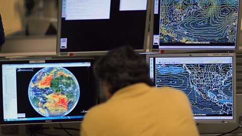
The centre uses satellite images, various weather instruments and computer-based prediction modelling to detect and track tropical cyclones. When tropical cyclones affecting populated coastal areas are predicted, the centre issues warnings.
Warnings give information to the local authorities of places likely to be in the tropical cyclones's path. This means that preparations can be made to try to protect public safety. These are broadcast over TV and radio and warnings can be issued to smart phones. People in vulnerable coastal areas are usually advised to secure their property and move away. In the USA, this can involve the mass evacuation of a million or more people.
Reinforced aircraft, fitted with various scientific instruments, fly through and over tropical cyclones to collect data. This can be used to help track and predict the path of a tropical cyclone.