Why was Hurricane Helene so damaging?

- Published
September's Storm Helene destroyed whole communities across six states in the south-eastern US and claimed more than 100 lives.
Helene first hit the US as a hurricane, the most powerful on record to hit Florida's Big Bend, before moving toward Georgia, the Carolinas and Tennessee.
The majority of deaths have been confirmed in North and South Carolina, after Helene weakened to a tropical storm.
Hurricanes typically decrease in strength as they travel over land, so why was Helene so destructive so far from the coasts? And was climate change partly to blame?
Why was Helene so bad?
In the days before Helene made landfall, it drew a lot of energy from the very warm waters of the Gulf of Mexico, strengthening quickly from a Category 1 to a powerful Category 4 hurricane.
High sea surface temperatures meant there was a lot of moisture in the atmosphere capable of producing a vast amount of rain and this moisture was carried deep inland by the storm.
Most very powerful hurricanes do strengthen rapidly but what was unusual about Helene was the sheer scale of the storm's rainclouds and wind field coverage.
Despite the storm making landfall on Florida's Big Bend, even cities such as Miami, many hundreds of miles away, experienced wind gusts of more than 70mph (110km/h), due to Helene's vast size.
It also meant the extreme rainfall took a long time to pass over any location in Helene's path.

North Carolina's mountains exacerbated the extreme rainfall and flooding
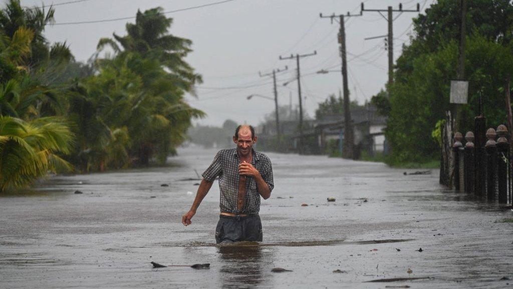
Why was North Carolina so badly hit?
More than six months’ worth of rain landed in parts of North Carolina as Helene passed through.
The mountainous western part of the state suffered huge impacts from the storm due to its topography, with homes and bridges washed away, villages flattened and the tourist city of Asheville cut off.
Mountainous terrain typically receives heavier rain than lowland areas.
Tropical systems also tend to bring especially heavy rain so it is not surprising that river levels rose so rapidly and flash flooding was so extreme, cutting off vulnerable communities in the state.
Sarah Keith-Lucas describes Helene's destructive path across the south-eastern US
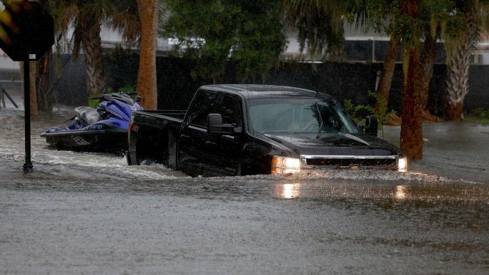
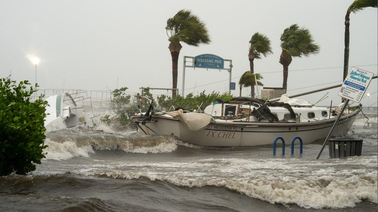
How bad was the flooding?
Helene brought historic flooding and a storm surge of more than 15 feet (4.5m) as it barrelled across the south east of the US.
Record flood crests were measured in at least seven locations in North Carolina and Tennessee. In parts of western North Carolina, records that had stood since the "Great Flood" of July 1916 were smashed.
The states in the storm's path had already had a lot of rain in the days before Helene's arrival, so the ground was already saturated. This meant flooding was more likely because the ground could not absorb any more water.
The destruction across the south-eastern states was also down to a phenomenon known as the “brown ocean effect”. This is when a storm continues to draw some energy as it passes over wet ground, so it does not fizzle out as fast as a storm that crosses dry terrain.
Could climate change have made Helene worse?

We could see the impacts of tropical cyclones reaching further inland in a warming world
Initial analysis of the storm already suggests that human induced climate change played a significant role in the amount of rainfall dumped by Helene.
claims that climate change caused over 50% more rainfall during Hurricane Helene in some parts of Georgia and the Carolinas.
found that cyclones similar to Hurricane Helene are up to 20% wetter over the south-east of the US and up to 7% windier in Florida's Gulf today compared to the past.
It is well understood that a warming climate means a wetter world. That is because a warmer atmosphere holds more moisture, which produces more intense rainfall.
Can we expect more storms like Helene this season?
The Atlantic hurricane season continues until the end of November and it is not unusual for storms to form even later.
So far this year, we have seen ominous signs of strong storms developing much earlier in the season due to the very warm waters of the Caribbean.
Back in July, Beryl became the earliest category five Atlantic hurricane in records going back around 100 years.
There was a lull in Atlantic hurricanes forming mid-season due to an unusual pattern in the West African monsoon, which prevented storms brewing in the area where they usually thrive.
The waters of the Gulf of Mexico and Caribbean are currently above average temperature, meaning there is more potential for powerful storms to develop through the rest of the autumn.
- Published27 September
- Published12 hours ago
- Published30 August 2023