What is the upper course of a river?
Rivers are bodies of water that move across land. All rivers can be split into an upper, middle and lower course.
In this article you can learn:
- Where a river begins
- Features of a river's upper course
- How waterfalls, gorges and other physical features are formed
- Wildlife you might find near or in the upper course
This resource is suitable for Landscapes topics for primary school learners.
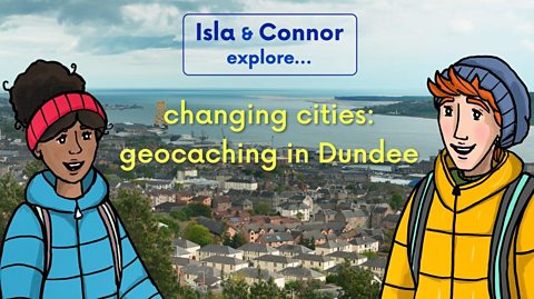
Video - The upper course of the River Tay
Join Isla and Connor as they explore the upper course of the River Tay.
Watch this short video to find out about the features of a river's upper course.
CONNOR: I’m so ready for this Isla. Can’t wait to explore the River Tay right from the very start – all the way up there near the top of Ben Lui!
ISLA: Me too! We’re going to get loads of information for our Rivers project. Big climb ahead though, better get going.
Ooh Connor! Did you know, the River Tay is the longest river in Scotland? 188 kilometres!
And, the Tay has the greatest volume of water of any river in the UK? Wow.
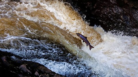
In 1922 Georgina Ballantine caught an enormous salmon in the Tay. Nearly 1.5 metres long!
CONNOR: Wow! Ah, we made it to the very start, the source, of the famous River Tay.
ISLA: Follow it to the end, we’ll be in Dundee! Look at the map.
Rivers usually start somewhere high up, like mountains, and run down from there. That’s why this first part of the river is called the upper course.
It’s not called the Tay yet, first it’s the River Cononish. Then it becomes the Fillan and then the Dochart. After Loch Tay the river is officially the River Tay.
CONNOR: Rain and snowmelt from all over this area drains into the Tay! That must be why it has so much water in it.
At least it’s downhill from here! Can we get in the kayaks now, Isla?
ISLA: We need to walk a bit further because…
CONNOR: Woah! A waterfall!
ISLA: Yeah, you wouldn’t want to kayak over that!
CONNOR: Wow, I’ve seen these birds before! Dippers! They are so cool, their bones are really heavy, so they sink and…catch their underwater dinner!
ISLA: Almost as amazing as the waterfall. Look.
Some rocks are harder than others. Waterfalls form when water flows from hard rock to soft rock. Soft rock wears away quicker than hard rock, this is erosion.
A ledge of hard rock develops as the soft rock erodes, forming a plunge pool. Eventually, the hard rock collapses into the plunge pool and over thousands of years the waterfall moves upstream, forming a gorge.
CONNOR: Impressive.
The river made this valley. Can you imagine how long that took? And how powerful the water is?
ISLA: I don’t think we need to imagine that, actually.
CONNOR: What do you mean?
ISLA: Keep up, Connor! Here come the Dochart Falls!
CONNOR: The wha…? Aaaaargh!
ISLA: We’re in the rapids! The river is steep here, so the water is really fast. And it’s shallow, so all the rocks make it really…
CONNOR: Bumpy!
Thanks for the explanation, Isla, I hadn’t noticed.
ISLA: I was going to say fun!
Let’s check the map again.
CONNOR: This is the end of the upper course of the river, from here it moves on to the middle course and becomes the River Tay.
ISLA: We’ve already travelled about 48 kilometres. Only 140 to go until Dundee!
CONNOR: Dundee feels like a world away from this! I bet there’s so much more to see on the river between here and there. Let’s go!
What is a river?
- A river is a moving body of water that flows across land from its Where a river starts. This is usually up high, like on top of a mountain. (on high ground).
- Eventually, a river flows into another body of water such as a loch, the sea, an ocean or even another river.
- Rivers are an important part of our water cycle.
- Rivers can be divided into the upper course, middle course and lower course.
")
What is the upper course of a river?
- The upper course is the section at the beginning of the river, nearest the source.
- Rivers usually begin in an upland area, like the top of a mountain. Snow melts or rain falls on high ground and begins to flow downhill.
- The upper course of a river is usually steep and narrow.
- The A river current is the flow of water being pulled by gravity as the water moves downhill. is fast in the steep upper course so the water has more energy and can wear away rocks and soil. This is called erosion.
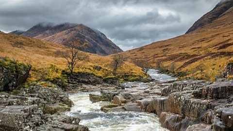
- Wearing away over time. in the upper course of the river helps to create V-shaped valleys, waterfalls, rapids and gorges.
Physical features of the upper course of a river
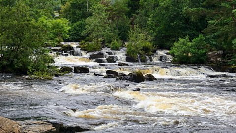
This slideshow shows some examples of upper course features.
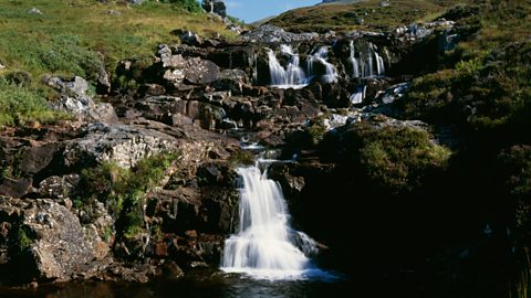
Image caption, Waterfalls
A waterfall forms when water flows from hard rock to soft rock. The soft rock wears away quicker than the hard rock. This is called erosion and helps create features like waterfalls, rapids and gorges.
1 of 4
Wildlife on the upper course of the River Tay
Discover some of the wildlife you might find in and around the upper course of a Scottish river.
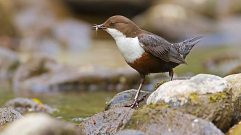
Image caption, Dippers
Dippers are a type of bird that are commonly found near fast-flowing rivers. They are known for diving underwater in search of insect larvae and freshwater shrimps to eat.
1 of 3

Key words about a river's upper course
- source - Where a river begins. Snow melts or rain falls on high ground, like a mountain, and begins to flow downhill. The source of the River Tay starts near the top of Ben Lui.
- upper course - The first part of a river. The upper course of a river is usually steep and narrow.
- current - The flow of water, in a river or stream, being pulled by gravity as the water moves downhill.
- erosion - When a material, like rock, wears away over time. The powerful water in a river's upper course causes lots of erosion in the landscape.
- waterfall - Water which falls over a steep rocky ledge into a plunge pool. Waterfalls form when water flows from hard rock to soft rock. Soft rock wears away quicker than hard rock in a process called erosion. A ledge of hard rock develops as the soft rock erodes forming a plunge pool. Over time, the hard rock collapse into the plunge pool.
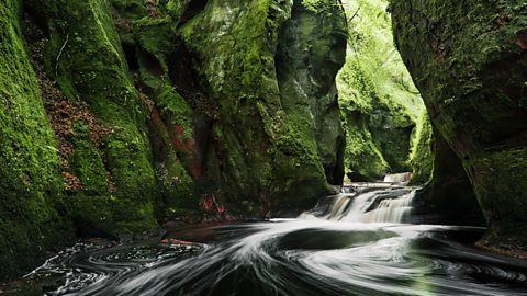
- gorge - A narrow valley with rocky walls. Over thousands of years, erosion causes waterfalls to move upstream forming a gorge.
- v-shaped valley - A valley with very steep sides, which look like the letter 'V'. Like waterfalls and gorges, a v-shaped valley is formed by erosion from a river or steam over a long period of time.
- rapids - Fast-flowing water in a steep, shallow area of a river.
Test your knowledge
Quiz
Try this short multiple choice quiz to test your knowledge of the upper course.
Challenge
Research your local area and find out where the nearest river is to your home. Can you create a map of the river?
A map is a drawing of an area. They are used to help plan routes from one place to another, or to find certain features such as castles or hills
Here is an example of a map of the River Tay.
Here are some things you might want to include on your map:
- A compass. The top of most maps is north and a compass can be used to find which direction north is.
- Where the river starts (the source). Is this up high on a mountain or hill? Could you use a An object or picture that stands for something else. to represent this?
- Where the river ends. This will usually be another body of water like a loch, sea or another river.
- Important places or A building, object or place that is easily recognised and helps you understand where you are. A castle is an example of a landmark. along the river's path. Are there any towns or villages that you want to highlight on your map? Could you use a symbol to represent the landmark?
- If you have used symbols, you might want to include a A map key is a table that explains what the symbols on a map mean. so people can understand what the symbols mean.
If you need more help with your map, you can learn more here: Geography Skills - Maps.
More on Landscapes
Find out more by working through a topic
- count24 of 25
- count25 of 25
- count1 of 25
- count2 of 25