What is a mountain?
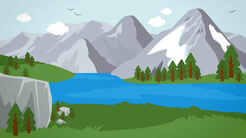
Mountains are landforms that rise above the land around them.
Usually, they are more than 600 metres high. They have steep sides and either rounded or sharp peaks.
Many mountains are part of mountain ranges, which are groups of mountains formed around the same time.
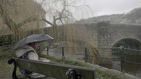
Watch: Explore the tallest mountains of the UK
Find out more about the tallest mountains in the UK.
Everyone likes a challenge and getting to the top of a mountain in this weather must be one of the most breathtaking in more waysthan one.
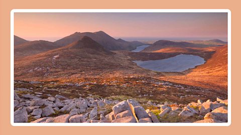
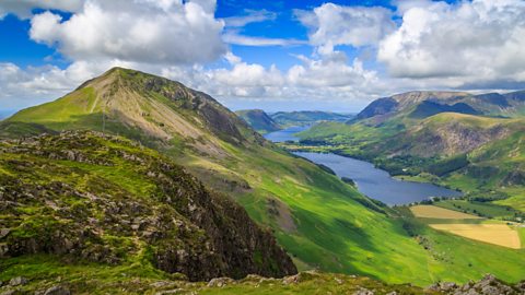
My name's Seren and today I'm exploring the UK's tallest mountains. I'm in Wales on my way up a mountain called Pen Y Fan, which is Welsh for top spot. And it really is.
It's the tallest mountain in a row or range of mountains called the Brecon Beacons in South Wales. This is what it looks like on a sunny day.
A mountain is an enormous rocky bit of land with steep sides that tower above the landscape around it, usually with a clear tip at thetop called a peak.
Pen Y Fan is 886 metres above sea level. Slieve Donard is the tallest mountain in Northern Ireland and it's 850metres tall. The tallest mountains in England are in the Lake District and the tallest of all is Scafell Pike, at 978 metres.
The tallest mountain in Wales is called Yr Wyddfa, but most people know it by its English name, Snowdon. It's an impressive 1,085metres tall.
But if you're really into mountains, you need to go to Scotland, where you'll find the tallest mountain in the UK: BenNevis, which is a mighty 1,345 metres above sea level.
But why are the mountains here? How were they made?
There were times called ice ages, when the whole of the UK was covered in gigantic sheets of ice called glaciers.
When they started to melt, they slid slowly across the land and their enormous weight carved away the softer rock, leaving the harder rock behind: the mountains. The last ice age ended about 12,000 years ago.
And these days the main problem for Pen Y Fan is the erosion caused by heavy rainfall and the hundreds of thousands of boots tramping up and down it every year. So always keep to the paths.
I hope you come here, or find the closest mountain to you and challenge yourself to reach the top.
But, maybe wait for better weather.
The tallest mountains

Some of the highest mountains of the UK are found in Scotland. The tallest is Ben Nevis, located in the Highlands region.
The tallest mountain in each of the four UK countries are:
Ben Nevis in Scotland (1,345 metres)
Scafell Pike in England (978 metres)
Snowdon in Wales (1,085 metres)
Slieve Donard in Northern Ireland (850 metres)

Ben Nevis was once a large, active volcano which exploded and collapsed in on itself.
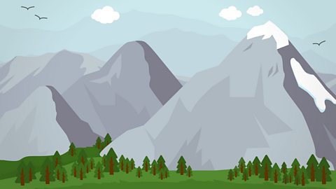
How are mountains formed?
Mountains are formed by forces deep within the Earth.
Liquid or air that flows in one direction in Hot, molten rock beneath the Earth's surface. cause heat to move closer and further away from the surface.These currents carry Large portions of Earth's crust. with them.
Read more about how mountains are formed here.
See how some types of mountains are formed in the UK.
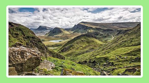
Image caption, Fold mountains
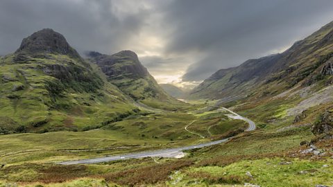
When tectonic plates collide, they create fold mountains. They are usually the tallest mountain ranges. An example of these is the Highlands in Scotland.
1 of 3
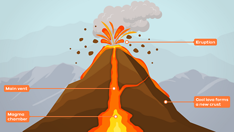
Volcanic mountains
Volcanic eruptions create new landforms such as volcanoes, craters and plateaus. Many of the mountains in the UK were once A volcano that could erupt. It can start to produce hot lava in the future or is already erupting. .
Volcanoes often form on the boundary between two tectonic plates.
If they push together, they can force hot molten rock, called magma, to the surface.
When they pull apart, they can cause Hot liquid that comes from deep within the Earth. to flow out over the ground.
Glacial erosion
Mountains, like the rest of the land, are always changing. They can keep building up or they can slowly wear away from the forces of erosion.
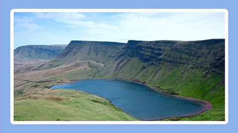
A large mass of ice and hard snow that moves very slowly across land or downhill. can scoop out a section of a mountain, creating a A hole in the side of a mountain, which has been carved out by a glacier. Often, a lake remains once the glacier melts away.. This can remain as a lake once the glacier disappears.
When glaciers move, they can scour the sides of the mountains, changing the 'v' river valley from a 'v' shape to a rounded 'u' shape.
Thousands of years ago, during the last ice age, most of the UK was covered by ice, so many of its landscapes have been formed by glaciers.
The Lake District in England is an example of these landscapes. Some of its lakes formed in deep ditches that were carved by glaciers.
Activities
Quiz: Mountains
Quiz: Human land use

Bitesize Primary games. game
Play fun and educational primary games in science, maths, English, history, geography, art, computing and modern languages.

More on Geography of the UK
Find out more by working through a topic
- count4 of 17

- count5 of 17
- count6 of 17
- count7 of 17