Scales
It may be useful to look at M1 Metric units units and M5 Constructions
When an object is being designed it is not usually drawn to actual size. Large objects are scaled down onto the page and small objects may be scaled up. This makes it more convenient to pass on information about the object or to discuss the design.
Scale factors are used to calculate proportional measurements. Maps, engineers' drawings, architects' plans, designers' drawings and models are produced using scales.
Map scales
A map cannot be the same size as the area it represents. It needs to be scaled down to fit on a page or a screen. All maps show a scale so that the actual distance can be calculated.
Example:
If 1 cm on a map is equal to an actual distance of 2 km, what is 8cm equal to?
Solution:
8 cm on the map is equal to an actual distance of 8 x 2km = 16km
8cm is equal to 16km
Example:
The actual distance between two villages is 15 miles.
Using the scale 1 cm = 3 miles, calculate the distance between the villages on the map.
Solution:
1 cm = 3 miles
‚ÄÉ‚∂ƒÉ‚∂ƒÉ‚∂ƒÉx5
? cm = 15 miles
1 x 5 = 5 cm
The distance between the two villages will be represented by 5 cm on the map.
Question
A theme park map has a scale of 1 cm = 250 m.
The distance on the map between the rollercoaster and the waterslide is 6 cm.
What is the actual distance between the rollercoaster and the waterslide?
Answer:
The scale is 1 cm = 250 m
The map distance is 6 cm
6 x 250 = 1500m
The actual distance is 1500 m = 1.5 km
Question
The distance on a map from Tower Bridge to the London Eye is 10 cm.
Find the actual distance in Kilometres?
Answer:
The map distance is 10 cm and the scale is 1 cm = 250 metres.
10 x 250 = 2500 metres
2500 m = 2.5 km
The actual distance from Tower Bridge to the London Eye is 2.5 km
Scale Drawing
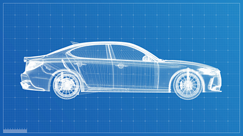
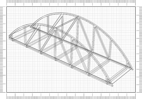
Designers, engineers and architects use scale drawings to show something which is too big to draw on a page or too small to be seen clearly.
In the exam you may be asked to draw a simple scale drawing.
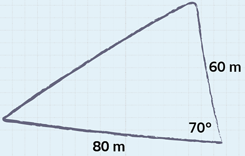
Example
The sketch shows a triangular field. Two of the sides have lengths 80 m and 60 m and the angle between them is 70°. Make a scale drawing of this field using the scale 1 cm = 10 m.
Use your drawing to find the actual length of the 3rd side of the triangular field.
Solution:
Using a scale of 1 cm = 10 m
80 m = 8 cm
60 m = 6 cm
An angle is unchanged when using a scale.
- Using a ruler draw a line 8 cm long.
- At one end of this line measure and mark an angle of 70°.
- Draw a line 6 cm long in the direction marked.
- Join the other two ends to make a triangle.
- Using a ruler measure the 3rd side.
It measures 8.2 cm. The actual length of the 3rd side of the field is 8.2 x 10 = 82 m.
Example
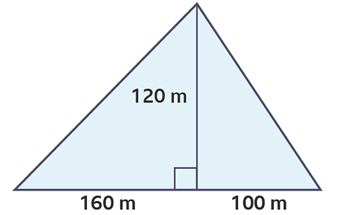
Make a scale drawing of this shape using the scale 1 cm = 20 m
(Practice this on a page using a ruler and pencil)
Solution:
160 m = 8 cm
100 m = 5 cm
120 m = 6 cm
Test yourself
Question 1
A map has a scale of 1 cm = 5 km.
On the map, the distance between two villages is 3 cm.
What is the actual distance between the two villages?
15 km
Question 2
A map has a scale of 1cm = 10 kilometres. The distance between two cities on the map is 4.8 cm.
What is the actual distance between the cities?
Answer:
48 km
Question 3
The distance on a road map between Belfast and Dublin is 16 cm.
The map has a scale 1 cm = 10 km.
What is the actual distance between the two cities?
Answer:
160 km
Question 4
A tourist map uses the scale 2 cm = 1 km.
The distance between two seaside resorts on the map is 12 cm.
What is the actual distance between the two resorts?
Answer
6 km
More on M5: Geometry and measures
Find out more by working through a topic