
Nasa: Raikoke volcano and other amazing photos of the Earth taken from space
- Published

An enormous volcanic eruption has been photographed from space by Nasa.
Astronauts who were on board the International Space Station took the picture of the Raikoke volcano.
Nobody lives on the volcanic island - so no-one was hurt - but a huge amount of ash and gas was thrown miles up into the sky.
The volcano sits among the Kuril Islands, which form the line between Russia and Japan.
Raikoke last erupted in 1924 but rumbled back to life this week.
Here are some other photos from space to give your imagination a rocket!
Aurora Borealis
The Northern Lights seen from space
The Aurora Borealis, or Northern Lights, is one of the Earth's most famous light shows.
Even in the UK, if you live far enough north, and conditions are right, you can sometimes see these lights in the sky from your own garden.
In this amazing video you can see what they look like from above!
The dazzling light show is caused when particles in Earth's atmosphere interact with the planet's magnetic field.
There are also lights around the South Pole called the Aurora Australis.
Earthrise

Take a good look at one of the most famous pictures ever taken.
This is called Earthrise - and for good reason. It was taken by astronaut Bill Anders on the Apollo 8 mission in 1968.
This iconic picture shows Earth peeking out from beyond the lunar surface as the first crewed spacecraft circled the Moon.
UK with the lights on

We have British astronaut Tim Peake to thank for this picture of the UK that you'd never normally see.
It was the middle of night in Europe as Tim Peake - who was living the International Space Station - passed over.
He took this picture of all the lights on in the UK and France - and if you look carefully you can also see the Aurora Borealis twinkling above.
Snaking river

This giant snake-like formation is actually the Green River in Utah, USA.
It has made a 300m deep canyon through the dry landscape.
The Green flows 730 miles through Wyoming, Colorado, and Utah and into the Colorado River.
The portion of the Green River in this image is just north of Canyonlands National Park - a popular destination for hiking, canyoneering, and river rafting.
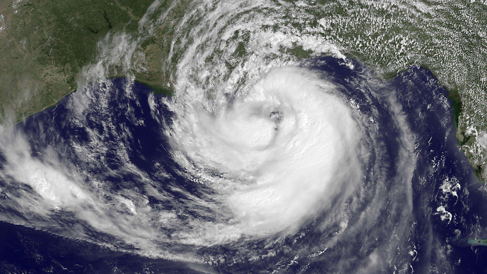
Hurricane Irma

Talk about a threatening storm!
This picture shows the size and scale of Hurricane Irma as it crashed into the USA in 2017.
The massive storm system had hit the Caribbean Islands earlier that month.
You can see the width of the storm and even the eye right at the centre - you can also see Hurricane Jose to the right, which followed closely behind.
Pictures from the ISS and Nasa satellites are often used to track weather patterns, to give emergency services vital information to try and keep people safe.
- Published31 August 2023
- Published14 April 2019
