On a hot summer’s day, the thought of slowly pootling along a canal on a narrowboat seems like an ideal way to kick back and relax (so long as you’re not steering!).
Around the world, canals come in lots of different shapes and sizes, and serve different purposes. Shipping canals like the Suez Canal and the Panama Canal allow huge container ships to take shortcuts, cutting their journey time by several days. In Venice, residents and tourists famously use the city’s canals to simply go about their day, hopping from island to island, street to street.
Join ±´”„tv Bitesize as we take a look at four canals that you might not have heard of, but which are all impressive in their own ways.
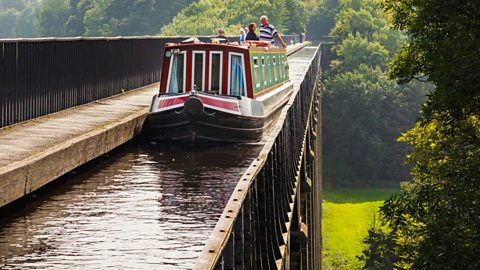
Pontcysyllte Aqueduct, Wales
Do you have a good head for heights? You’ll need one if you travel by boat or foot across Wales’ Pontcysyllte Aqueduct, which forms part of the Llangollen Canal. Soaring 126 feet (38m) above the River Dee Valley, there are railings along the pedestrian footpath but for anyone steering a boat across, there’s a sheer drop on one side. Not for the faint of heart!
The Pontcysyllte Aqueduct is the longest and highest of its type in Britain, and it was built during the Industrial Revolution, with construction beginning in 1795. It opened on 26 November 1805. Designed by Thomas Telford and approved by William Jessop, it was built using cast iron supplied by foundries in Shrewsbury and Cefn Mawr. The 1,007 feet (207m) long cast iron trough is supported high above the valley by stone piers. Interestingly, the mortar used to bind the stone together was a mix of lime, water and ox blood!
In 2009, Pontcysyllte Aqueduct was officially designated a UNESCO World Heritage Site and within the UK, it is listed as a Scheduled Ancient Monument of National Importance and an Area of Outstanding Natural Beauty. Its Welsh name translates to English as ‘the bridge that connects’.
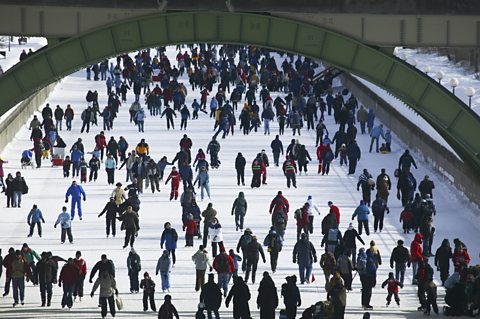
Rideau Canal, Canada
When it comes to canals, most people either use them to travel by boat or make use of their associated towpaths for walking, running or cycling. But in Ottawa, the capital city of Canada, they skate down the Rideau Canal.
Depending on the weather, each year there’s a period of time during which the frozen Rideau Canal is solid enough that it’s possible for the general public to safely skate along it 24 hours a day, for free. When this happens, the canal becomes the world’s largest skating rink at 7.8km (4.8 miles) long. Normally, this happens sometime between January and early March. The longest period of opening was 95 days, during the 1971-1972 season.
As well as skating, other activities have taken place on the frozen canal, often tied in with the city’s Winterlude festival in February. These have included:
- Curling
- Ice-carving
- Ice dragon boat races
- Triathlon
- 150 shinny hockey (informal, outdoor version of ice hockey) games to celebrate Canada’s 150th anniversary in 2017
The canal itself was constructed in the early-19th century, and it stretches for 202km (125.5 miles) between Ottawa and Kingston Harbour on Lake Ontario. It was designed for steam-powered vessels and to this day is still operational. In 2007, the Rideau Canal became a UNESCO World Heritage Site.
For the first time since 1971, the Rideau Canal was not deemed safe enough for skating at any point over the winter of 2022-2023. The ice must be 30cm thick, which typically means 10-14 consecutive days of -10 to -20 degrees Celsius temperatures. Higher than average temperatures prevented this, and research commissioned by the responsible authority indicates that warmer weather caused by climate change has shortened the average skating season by roughly four days a decade.
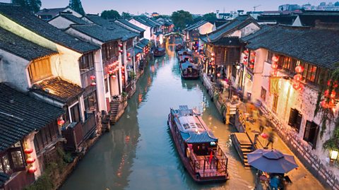
Suzhou, China
Sometimes referred to as the ‘Venice of the East’, Suzhou is an ancient Chinese city which is home to numerous canals. One of these is the Beijing-Hangzhou Grand Canal, the longest man-made waterway in the world at approximately 1,776km (1,200 miles) long. Its entire length has been designated a UNESCO World Heritage Site, but not all of it is currently in use. The oldest sections were built in the 5th Century BC.
Within Suzhou, the canal is flanked by historic gates, stone bridges and temples. One of these is the Wu Gate Bridge which was originally built during the Song Dynasty, but was later rebuilt during the Qing Dynasty, and is the highest of its type in the city.
Suzhou’s downtown area is surrounded by a large rectangular canal known as the Weichang River or City Moat, which has traditional tea houses and opera theatres sat alongside.
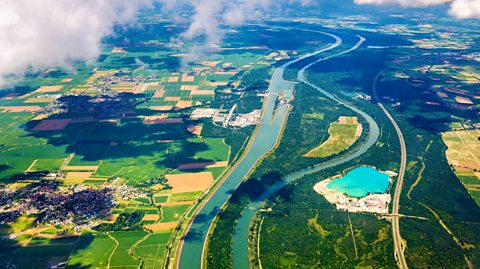
Grand Canal d’Alsace, France
Running along the Rhine River in eastern France, the Grand Canal d’Alsace is able to generate hydroelectric power at a number of its locks.
The Rhine River has always been tricky to navigate, and, prior to World War One, the possibility of building a canal alongside it was considered. At the end of the war, the countries involved all signed a peace agreement known as the Treaty of Versailles in 1919. Part of the treaty gave France authorisation to start work on building the canal and use it to generate hydroelectric power. The first section opened in 1932 in Kembs.
As work continued across the decades, greater consideration was given to how much of an environmental impact was being had on the Rhine River and the design was altered accordingly. Now 50km (30 miles) long, the Grand Canal d’Alsace allows boats to move between Basel, Switzerland and Breisach, Germany. In addition to generating electricity for the region, the canal also provides water to the Fessenheim nuclear power plant.
This article was published in June 2023
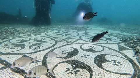
Looking for Atlantis? Five underwater cities from around the world
Dive below the surface and explore these incredible submerged communities.
Six of the world’s most amazing railway journeys
From the highest railway to one of the longest, these aren't any ordinary train journeys.
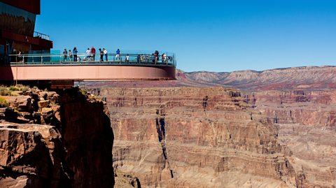
Four incredible feats of engineering from around the world
From the tallest road bridge in the world to a glass walkway above a major river.